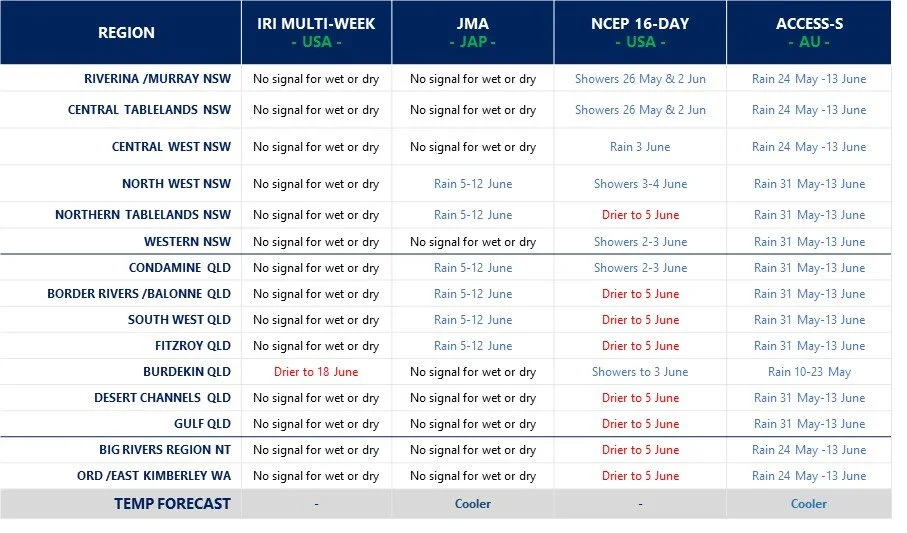
Multi-week planner (8-28 days)
/The latest global cloud (OLR) predictions show heavy cloud crossing the Australian continent from 16-22 June - which seems to have the BOMs access model very excited for June (bottom figure). However, none of the other models are having a bar of it. There is no strong tropical influences or other active remote drivers behind the increased cloud cover bringing moisture, so caution required on this bullish wet forecast currently making air waves. The best chance for rainfall seems to be during weeks 2-3 of June, but no big amounts predicted, and more in line with median totals for the month.
Model commentary: Another day at the track with bookmakers salivating at the erratic form shown in the field of runners to date. The mid-field cluster seems to be centred around the IRI and JMA models playing it safe on the rails over the distance. The sprinter over the mile, NCEP, is still showing little excitement and reason to be popping corks through the latest campaign. The main talk in the betting ring is the poor form of stallion ACCESS-S, which could well come back as a gelding next week unless it can show the punters why they should remain loyal and optimistic.
Go to 10-day Forecast XL for a full summary of all ‘weather models’ as rain events draw closer for your area: https://meteologix.com/au


