

Multi-week planner (8-28 days)
/Every now and then we are reminded why this ensemble is useful for multi-week planning with a cross-section survey of models. The latest BOM multi-week guidance would suggest a flood for central Australia (see map added below), however, other international models have taken a very different view. For those still harvesting/picking summer crop or weaning calves etc., it looks like more of the same: fine weather until the 1st week in June when a weak change is developing. The foreseeable event early in June is tending to favour N NSW and S Qld areas, making this event pretty tricky to predict, as models don’t do easterly influences that well. The BOMs ACCESS S model has shown us that it gets way too excited by the Indian Ocean or MJO wet signals and this looks like one of those occasions.
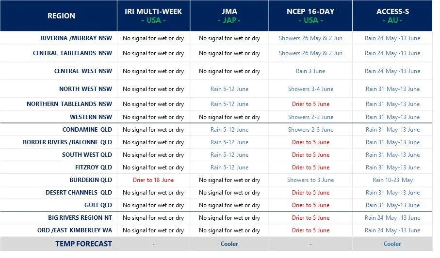

Model commentary: A fair spread on the field this week with the IRI and JMA sitting midfield and jockeys content to sit on the rails and not set the pace over the distance. On the other hand, the stewards look set to investigate ACCESS-S after streaking to the front in a show of exuberance, only to then shy at a pink dress in the crowd near the winning post and spear the jockey. NCEP is more comfortable at the tail of the field, more cautious than most, although has good form nonetheless over the shorter distance.
Go to 10-day Forecast XL for a full summary of all ‘weather models’ as rain events draw closer for your area: https://meteologix.com/au
