


Climate in-brief
/The MJO is set to have little influence over Australia, as it is predicted to weaken as it enters the Maritime continent region to the north of Australia.
The remainder of May looks dry for much of the northern tropics, Qld and NSW. A weak rain-bearing system is more likely in weeks 1-2 of June, although the strength of the system is unconvincing at this stage.
A check on international seasonal model guidance for the winter season favours mid-tercile (average) precipitation and temperatures. Some encouragement for the spring season as a wet phase Modoki and Indian Ocean develop.

The chart above shows very little change from last fortnight. The low off NSW has since moved away and the high pressure ridge has intensified.
Australian daily and weekly rainfall observations

Very little rain in the 24hrs to 9am.
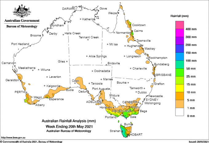
Weekly rain symptomatic of the intense high-pressure system over Australia (above).
Australian 7-day rainfall map courtesy http://www.bom.gov.au/climate/maps/rainfall/?variable=rainfall&map=totals&period=week®ion=nat&year=2020&month=12&day=17